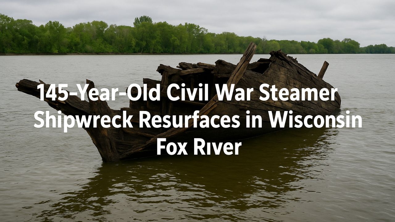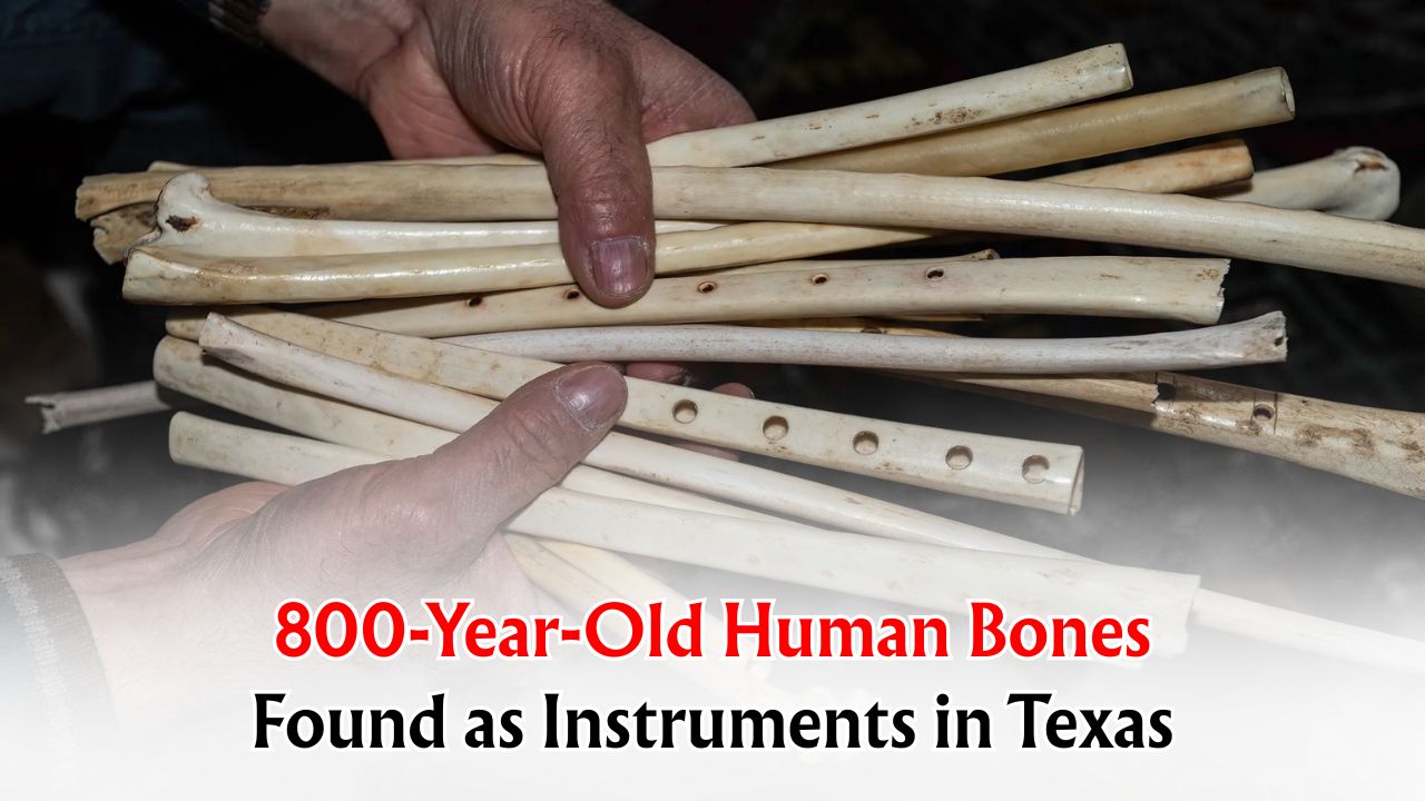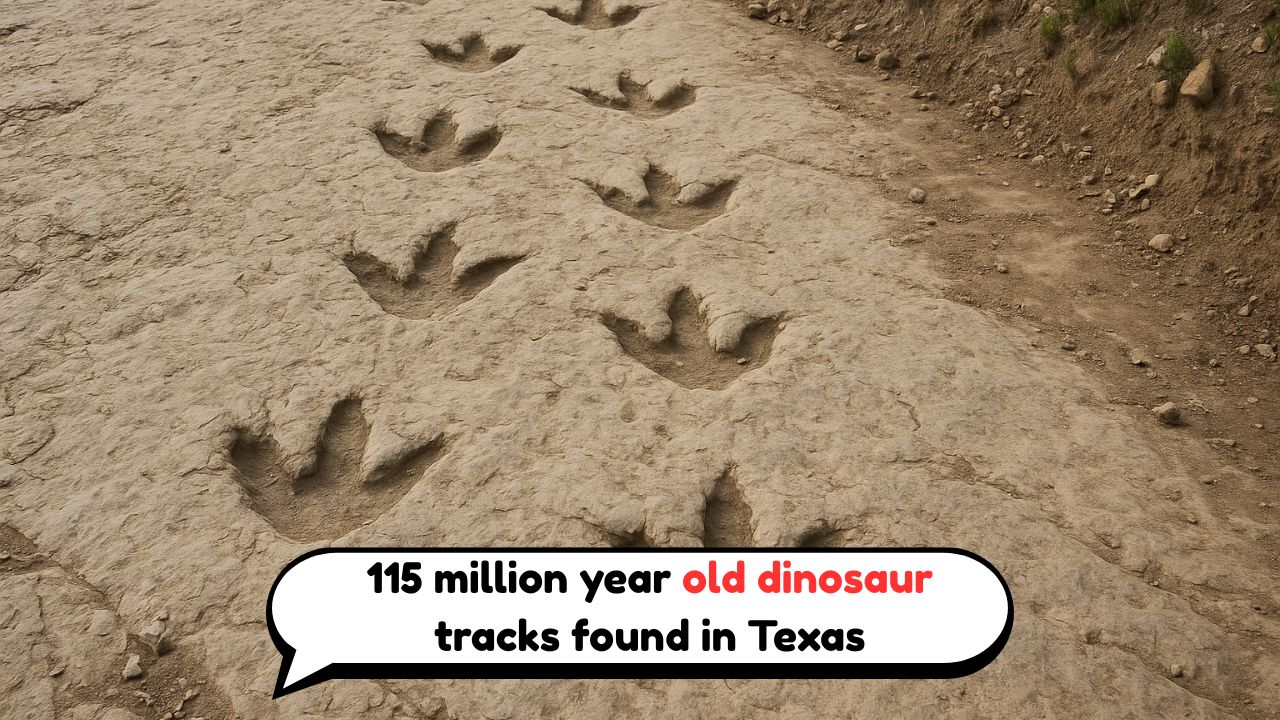
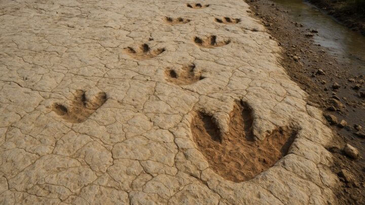
115-Million-Year-Old Dinosaur Footprints – After days of torrential Texas floods, the rushing water finally receded—and with it came a breathtaking surprise: a fresh trackway of fifteen three-clawed footprints pressed into a ribbon of pale stone. Each print shows sharp toe pads and a narrow heel, the classic signature of a meat-eating dinosaur pacing a soft shoreline 115 million years ago. Sunlight caught the pooled water in the depressions, highlighting the depth of each step and the steady rhythm of the stride. Locals first noticed the shapes along an exposed riverbed cut clean by fast water, then called county officials, who alerted paleontologists. Within hours, volunteers were staking off the area to prevent damage while experts photographed, mapped, and measured the impressions. The discovery doesn’t just add a number to a fossil list; it captures a living moment—a predator walking, pausing, and pushing off again—in sediment that hardened into history. In a landscape reshaped by storms, the past quite literally stepped back into view.
What the Three-Clawed Tracks Reveal
Paleontologists reading the newly exposed trackway treat it like a moving diary. The three forward-pointing toes and narrow heel indicate a bipedal carnivore—what scientists call a theropod—crossing wet ground with purpose. Subtle details, like deeper pressure at the tips of the outer toes and a pronounced push-off ridge, hint at the animal’s weight shift as it walked. The spacing between prints suggests a confident, unhurried pace, not a sprint, with occasional variations where the substrate changed from sticky mud to firmer sand. Fine ripple marks and raindrop pits preserved alongside the impressions help reconstruct the setting: a shallow shoreline or river margin during the Early Cretaceous. By comparing the footprint length to stride, researchers can estimate hip height and approximate body size, then model speed using well-tested formulas. While the trackmaker’s exact identity remains uncertain without bones, the anatomy of the prints points to a medium-to-large predator, a top hunter that would have shadowed herds and fished along water edges, leaving behind the moment we see today.
How Floods Exposed a Hidden Trackway
Extreme weather can destroy—but it can also reveal. In this case, floodwaters surged along the river corridor, stripping away loose gravel, silt, and tangled roots that had blanketed the bedrock for decades. As the current scoured the channel, it shaved off just enough sediment to uncover the hardened mudflat where the dinosaur once passed. When the water dropped, the prints appeared as darker, water-holding ovals surrounded by pale limestone. Because such windows are temporary, teams moved quickly: photogrammetry captured high-resolution 3D models; drones mapped context; and field notes recorded crack patterns, ripple directions, and micro-layers that can vanish with the next storm. Ironically, the forces that reveal tracks are the same forces that can erase them, so protection is a race against time. Temporary barriers, soft brushes instead of metal tools, and minimal contact ensure the surface remains intact while scientists collect the data needed to preserve the trackway digitally and, where feasible, stabilize it on site for the public to see.
Why 115 Million Years Matters
The age places these tracks in the Early Cretaceous, a time when warm seas lapped across what is now Texas and wide river deltas stitched together wetlands, sandbars, and tidal flats. Plants such as conifers and cycads lined the banks; insects hummed in fern thickets; turtles, crocodyliforms, and fish crowded channels. In that world, theropods patrolled shorelines while long-necked herbivores browsed higher ground—and both left stories in the mud. Trackways add a dimension that bones alone cannot: behavior. They reveal gait, speed, group size, and even moments of hesitation or detours around obstacles. A single series of fifteen prints can calibrate climate models by tying living movement to sediment types and water levels, helping scientists refine maps of coastlines and floodplains. For educators and visitors, the age figure turns a curiosity into time travel; the number is not an abstraction but a timestamp stamped in stone, connecting modern floods to ancient footsteps.

What Happens Next: Protection and Public Access
With the trackway documented, the priority shifts to safeguarding it. Officials typically fence off the immediate area, install clear signage, and, if needed, lay protective geotextile and clean sand back over the prints to shield them from sun, foot traffic, and future scouring. Researchers curate the 3D models for museums and classrooms so the public can examine each claw tip without risking damage in the field. If a section is stable, guided viewings may follow—short windows when water levels are low and the surface is safe to approach. Community help remains vital: hikers and anglers are encouraged to report new finds, avoid walking on impressions, and photograph from the edges. Local schools often join with “site-steward” days that turn fossil protection into hands-on science. Whether the trackway stays visible or is reburied for its own protection, the discovery has already done the job of a great museum exhibit: it stops you in your tracks, then sends you home seeing riverbanks and storms with brand-new eyes.